Needed if the device does not turn on, or the original software has stopped functioning. Update software will help if the device slows down or loads slowly. In other cases, it is better not to perform any such manipulations with the device. As long as the device works stably, there is no need to experiment with it.
Changing the firmware is quite simple. To do this, you don't need to understand technical features Explay navigator. But if you do something wrong, the gadget may become unusable. Therefore, reinstall the software only as a last resort.
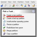
You need a computer, a USB cable included in the package, and a microSD card (minimum 2 GB - the size depends on how much memory the Firmware takes up). May require PC connection.
Before flashing the Explay navigator, do the following:

Firmware via computer
Here's how to flash the Explay navigator using a computer:
- Turn it off.
- Unpack the directory with Firmware on your PC (you need to download it in advance). The folder name must not contain Russian characters or spaces.
- Connect your navigator to your computer using a USB-microUSB cable. If you have not connected the device to your PC before, the drivers will be automatically downloaded. If the system does not find them, you can specify the path to them.
- Go to the directory where the firmware is located and run the installation (double-click on the executable exe file).
- Follow the installation wizard instructions.
- If that doesn't work, try the same thing by turning on the device.
Each device has its own Firmware. If you try to load software designed for Explay SLS7 onto an SLK5 model navigator, nothing will work. And that's the best case scenario. Most likely, the gadget will simply break.
You should not install unofficial applications if you are not sure that they work properly. Programs developed by enthusiastic users can be useful. But sometimes such software produces errors. Even one “broken” file can lead to problems.
Firmware via SD card
Here's how to install the firmware on the Explay SLS7 navigator and other models:

After this, you can download programs to Explay.
- Turn off your navigator.
- Insert the SD card into it and turn it on again.
- The device should automatically install the software. But sometimes you have to press certain keys to do this. It depends on the model (SLS7, CTS5, ND-41, Onliner and so on). Detailed instructions should be in the instructions.
- Do not restart Explay while downloading is in progress. In some cases it is not displayed at all.
- To prevent the device from running out of power, connect it to a power outlet. This shouldn't take too long. The battery will not have time to drain. But it's better to be safe.
- After the update, you will have to re-enter the keys for the programs.
Calibration
The firmware of an Explay device can “knock down” the screen calibration parameters. Here's how to restore them:
- Pinch the top left corner of the display.
- Or place your finger in the middle of the monitor and simultaneously hold the power button to the right.
- After 30 seconds, the calibration menu will appear - a cross on a white background. You need to “hit” it several times with the stylus.
Reflashing the Explay navigator will help if there are any problems with the device. Updating the software will improve its efficiency. Installing new Firmware is quite easy. But if the device is working normally, it is better not to reinstall anything.
How to update Explay navigator via computer? Do you need any programs for this? Is it possible to do everything quickly and simply? step by step instructions, and where to get it? Navigator owners may have a great many questions, and there is an answer for everyone.
What is needed to update maps?
Software equipment from Navitel is used on many GPS devices, including Explay navigators. As software updates appear on the official website, many users begin to ask themselves the pressing question of how to update Explay navigator maps.
This whole process is quite simple and does not require special technical skills - every computer user can easily follow the instructions that are posted on the official Navitel website. To update maps you need the following things:
- the device itself, for example, the Explay PN 970 navigator;
- cable for connecting to a PC;
- computer with Internet access.
When everything you need is nearby, you can understand the options for updating maps. There are two of them - new and old. It is better to choose the one that is more familiar.
The first version of the update, it’s new

This method consists of performing the following sequential steps:
- Go to the official website Navitel.ru and in the “Download” tab select the action of the same name.
- As a result, the Navitel Navigator updater program will be downloaded to your computer and will need to be installed.
- Launch the program and follow simple instructions.
In this case, the user’s participation is minimal; everything comes down to clicking the “next” button and waiting for the process to complete. The advantages of this method include the fact that the program independently, without user intervention, selects programs and cards that need to be updated.
For reference! The user can influence the process by choosing one thing to update - a card or a program.
Second (old) option or manual method
 Registration on the official Navitel website
 This method is a little longer. Here you will need to perform the following steps:
- Go to the Navitel.ru website and click on the “Registration” button in the upper right corner.
- Fill out the fields in the form and click on “register”. When filling out the “mail” and “mail confirmation” fields, you should be careful - they must match.
- Wait for a letter to the address indicated in the form email. Clicking on the link will confirm the correctness of the entered data and affiliation email box to a specific user.
- When confirmation is successful, it’s time to log into your personal account. To do this, on the site in the same right corner, instead of registering, you need to go to authorization, enter the necessary personal data in the appropriate fields - “login” and “password”, then click “login”.
- In the upper left corner of your personal account you will see several columns, including “my devices”; after clicking on it, the “add new device” button will appear. One click on this button and a window appears, where the model name is entered in the first line, for example, Explay PN 970 or PN 930, and the activation code in the second.
- When all the fields are filled in, you need to click “add” - the device will appear in the list of available ones, and opposite there will be a link with available updates.
The preparatory stage is completed.
 Key activation form
 Important! The activation code can be found if, after connecting the navigator to the computer, you go to the root directory of the built-in disk (memory), and not the removable one. After opening the file, the license key will be visible on the second line - Navitel license key.
Now you can go directly to updating the navigator, and this process consists of the following steps:
- IN personal account select the desired registered device, for example, Explay PN 970, and click the “available updates” link opposite it.
- In the list that appears, you need to find an exact match with the name. This is important because each requires a different update program - even if the difference is one letter or number, the update will not work. When everything is found, you need to download the archive.
- In the same list you can find and download the latest maps for the territory that interests the user.
The final step will be to transfer the downloaded update for Navitel and maps to the device you are using:
- Connect your navigator to your computer.
- Open the archive with the program using the archiver.
- Replace the file of the same name in the Exploy navigator with the NaviOne folder from the archive.
- Copy the license file (NaviTelAuto_Activation_key.txt) to the program folder - without it, full operation is impossible.
- Transfer the downloaded file with maps to the Navitel content\maps folder.
The finish line has been reached and the updates have been installed. If the first launch takes a little longer, do not be alarmed - the device searches for satellites and starts the calibration process. In the future, everything will work as usual.

Review of the Explay iD-41 car navigator: inspired by intelligence
The Explay company is far from new to the production of navigation equipment and, in particular, car GPS navigators. The manufacturer's catalog contains about thirty models with a variety of functionality, software, technical characteristics and form factor. The iD-41 model can be called a new round in the development of the navigation equipment segment of the Explay company, since the program operates as software in the navigator GPS satellite navigation iGO, or more precisely the latest version of iGO Primo.
Using iGO cards is an interesting and quite fresh solution, but first let’s look at the devices themselves.
The navigator has extremely modest dimensions, it certainly will not interfere with the driver’s view
Delivery package and appearance of Explay iD-41
The Explay iD-41 navigator is supplied in the now familiar “Ecopack”, i.e., environmental packaging, light brown in color with white font. The packaging looks compact and reliable. The equipment is tightly packed into the appropriate slots, so that any damage during transportation is virtually eliminated.
In the box the user will find: navigator, USB cable, car charger, car holder for the navigator, operating instructions and warranty card. By the way, Explay provides warranty service to all mobiles digital devices for a period of one year.

Typical Explay silver trim
As for the appearance of the device itself: it is a small 4.3” device in a black case with silver trim on the ends. On the left side of the navigator there is a slot for microSD cards, a USB connector used to recharge the device and connect to a computer, and a Reset button. On the top edge there is a button to turn the device on/off; on the back wall you can only see the grille of the built-in speaker. From a purely aesthetic point of view, the Explay iD-41 makes a favorable impression; the glossy black plastic of the body goes well with the matte silver wide edge. In addition, the quality of materials and workmanship is unquestionable. The body parts do not play or press through.
A car navigator holder is a regular suction cup bracket that is connected to the tray for the navigator itself through a ball that allows you to change the tilt angle of the device along the vertical and horizontal axes. Despite the fact that the Explay iD-41 body does not have any grooves, it fits tightly into the tray and does not shake as it moves, much less jump out. When looking at the holder, it is not difficult to notice the stylus hidden in it.

The weight of the device is comparable to the weight of a smartphone
There is a place for it directly in the tray for the navigator; you get the stylus from the back wall of this tray. The solution looks functional and quite convenient, but there is one “but”. The stylus fits into the groove quite freely, so it rattles a lot when moving, which sooner or later will irritate even the most patient driver. So, perhaps, it would be more reasonable to store it in your breast pocket or in an ashtray if it is not used for its intended purpose.
| Model
|
|
| GPS navigator |
Explay iD-41 |
| System
|
|
| OS |
Windows CE 6.0 |
| CPU |
ARM9 application processor, 550 MHz |
| Chipset |
Mstar MSB2521A |
| Built-in memory |
2 GB |
| Memory cards |
microSD up to 16 GB |
| Screen
|
|
| Specification |
4.3” TFT touch |
| Permission |
480x272 |
| GPS module
|
|
| Frequency |
1585.42 MHz |
| Channels |
64 channels |
| Sensitivity |
- 161 dBm |
| Update frequency |
1 sec. |
| Navigation
|
|
| Cards |
iGO Primo Russia map, complete with full pedestrian and bicycle navigation |
| Additionally | ability to install maps of Europe via Naviextras |
| Media functions
|
|
| Video formats |
ASF, AVI, MP4, 3GP, WMV |
| Audio formats |
MP3, WMA, WAV |
| Image formats |
JPEG, BMP, PNG |
| Text formats |
TXT |
| Nutrition
|
|
| Battery |
3.7V / 850 mAh |
| Navigation time |
up to 2.5 hours |
| Interfaces
|
|
| USB |
2.0
|
| Dimensions
|
|
| Size |
122 x 76 x 10.5 mm |
| Weight |
133 |
Functionality of Explay iD-41
When you turn on the navigator for the first time, the user is taken to the main menu, where he can select one of six functions:
- Navigation
- Music
- GPS info
- Books & Photos
- Video
- System
We will leave the multimedia and information functions of the Explay iD-41 for now and move straight to the main thing - navigation. When you click on this button, you will be offered a choice of three maps, the factory settings assume only one preinstalled map - iGO Primo, the user can install the other two (Navitel and CityGuide) independently, but we will not touch on this issue anymore, because, What interests us most is the performance of the device out of the box. So, choose iGo. Loading the map takes about five seconds on average, after which the device automatically determines the location. We did not have any problems finding the satellite signal. The navigator finds itself both outdoors and indoors.

All connectors are located on the side edge
After loading, a nice interface appears on the screen: a mini screen that displays the current location and three buttons - Search; My route; Additionally. Since we're talking about the interface, it's worth saying a few words about iGO cards in general. iGO is a GPS satellite navigation program created by the Hungarian company NNG. This version- iGO Primo, today is latest version manufacturer cards. The characteristic feature of iGO Primo is its simple, friendly user interface and rich functionality. In addition, it is worth noting that iGO Primo uses mapping from Navteq - the world's leading manufacturer digital cards, used in numerous software packages for car navigation systems. For information, Yandex bought maps from Navteq to create detailed map world on Yandex.Maps. But let’s not focus too much on “lyrical digressions.”
When using the Explay iD-41 for the first time, the route is set through the “Search” button, where the destination data is entered. Data can be entered in the form exact address, and in the form of “Objects”, for example, the navigator can easily find the nearest gas station, restaurant, bank, shopping center and much more. There are no problems with data entry, the navigator responds perfectly to both the stylus and the touch of a finger, no sticking or slowdowns.

The power key is located on the top edge
When withdrawing the card to full screen the user sees a nice three-dimensional picture with a detailed depiction of the terrain. In the settings menu, which opens by clicking on the “Advanced” button, the user can change appearance interface by choosing the design you like best from fourteen options. With the standard interface, the mapped route is highlighted with an orange line in the daytime scheme and a purple line in the nighttime scheme. Switch from day to day night scheme happens automatically according to general parameters daylight hours of the area.

iD-41 interface with standard settings
Naturally, Explay iD-41 also includes voice accompaniment. Despite the fact that the manufacturer declares support for only three languages - Russian, Chinese and English, voice guidance can be installed in almost any European language, including the Baltic, Balkan and even Turkish. As usual, there will be a choice of men's or female voice. It is worth remembering that voice acting is not always as appropriate as it seems. For example, when driving along the interchanges of the Moscow Ring Road or the Third Transport Ring, in general, in places where exits and turns are located directly one after another at a close distance, it is not always possible to distinguish which exit the voice guidance calls “next”. On the other hand, even if the required turn is missed, the system will quickly recalculate the route; there are no problems with this function in the navigator. The undeniable advantage of voice accompaniment is timely warning about speed limits and the presence of security cameras.
The route layout can be set by the user based on four parameters: “Fast”, “Green”, “Short”, “Simple”. There are also a number of parameters that a car enthusiast can exclude when planning a route. For example, the route may be detoured toll roads, unpaved roads, crossings, highways, etc.

The display is equipped with a resistive touch layer; it does not support multi-touch, but it can be operated with gloves
Actually take a look at additional features The navigator is extremely interesting. The "Additional" folder, in addition to multimedia functions, contains quite useful information, which will be useful for people traveling long distances, especially outside Russia. For example, the “Country Information” folder will inform the driver about the basic traffic rules in a particular country. The catalog of countries contains both neighboring countries, as well as Europe, the Middle East, and the USA. The unit conversion function will also be useful, especially the recalculation of fuel consumption, say, from liters/kilometers to gallons/miles. Here the user will find information about the duration of daylight hours, sunrise and sunset times. Other interesting feature called "Clothing Size", which presents in the form of a table the ratio of men's and women's clothing, shoes, underwear, accepted in a given country.
The functions collected in the “Traveller Monitor” folder deserve special attention. This function may be of interest to employees of taxi companies, courier services, delivery and moving services, in short, those areas where control over the route of movement is necessary. Through the “Traveller Monitor” the route recording is enabled. Once the recording is complete, the corresponding window will display data on speed, total travel time and distance, stop times, fuel consumption, etc. The route can also be viewed on the map. If the driver for some reason deviated from the given route or made too long stops, this will become known. Also, through the “Settings” menu in Explay iD-41, you can create a driver profile if the company car is used in shifts. A total of four profiles can be set. Subsequently, the route can be linked to a specific driver profile.

The navigator package includes everything needed for installation and synchronization
Saying goodbye to Explay iD-41
In conclusion, I would like to say only one thing: Explay iD-41 left an extremely positive impression. This is a truly high-quality device, with which no problems were identified. If we remember the wide capabilities and pleasant interface of the Explay iD-41, we can only be happy for those drivers who choose this device, the price of which, by the way, does not exceed 3,000 rubles.
Life and technology do not stand still, everything is constantly being improved and updated. Speaking about the navigator, it should be noted that many car enthusiasts prefer to use them. They believe that navigators make life easier for those who have poor road orientation. In this article, let's talk about how to update the Explay navigator.
Navitel software update
Such a popular company as Explay prefers to use the services of Navitel, which is famous for its high-quality updates. As soon as the fifth version of the Navitel Navigator program was released, many motorists decided to update their navigator. Users trust the program because it is constantly being improved in the world of technology. The good news is that the program is suitable not only for new, but also for old navigators. The update itself has interesting program, which surprised many with its functions:
- Sensitivity to traffic jams has increased significantly.
- The “avoid turns” option is in full demand.
- It is now possible to create new routes along the route without returning to the starting point of the route.
- The Dynamic POI service has become fully usable.
Installing the Navitel Navigator-5 program
Installation is quick and most importantly simple.
- Download the archive navigation program version 5.0.0.693 and unpack it on your computer.
- Create a “Navitel” folder and transfer the contents of the unpacked archive there.
- Be sure to transfer the activation key to the folder with the program. If you accidentally did not save it, then download it again in your personal account.
Here are a few more additions to the program:
- Fast new routing, now building routes is much faster - just a couple of seconds.
- Optimized maneuver when setting up a route.
- The program interface itself has been improved.
- It has become much faster and easier to find an object at a specific address.
- It is now possible to support cards of a new format with fast indexing nm3.
- Temporarily closed roads are now displayed.
- The off-route sensitivity setting is enabled.
- Another one has appeared additional customization– auto-scaling of path movement.
Installing and updating the navigator map
Let's look at how to update your Explay navigator map for free
- We connect the navigator to the computer. If your Navitel program is located on a separate flash card, you need to remove it and open it on your computer. Next we will work with this flash card.
- In the root of the map you need to create a separate folder for other maps, for example for UserMaps. We do not touch all other folders and do not save anything in them. To prevent possible conflicts between official and other maps.
- In the created UserMaps folder, make another folder for the map of the region that you want to include in the atlas. Let it be Region1.
- Copy all the files of the new map to the Region1 folder.
- Insert a flash card into the navigator.
- In the Navitel Navigator program, select a menu item called “Open Atlas” and click on the folder icon at the bottom of the window to create a new atlas.
- A window appears in which we find the Region1 folder, where we have new maps, open it and select the “Create atlas” command.
- We are waiting for indexing to complete and the atlas to be created. Then press the check mark button.
- Everything can now be used new map by checking the required atlas in the list.
Now you know how to update your Explay navigator for free and the easy way. This will allow you to take full advantage of all its capabilities. This means you will never get lost anywhere, and will quickly find your way to your destination.
Maps and navigation programs for Explay navigators.
GPS navigator Explay GTR5 has a 5-inch display with an optimal resolution of 480x272 pixels. Internal memory 4 GB, supports memory cards. 1200 mA battery. hour. Provides operation up to 3 hours. The navigator runs under Windows CE OS with licensed Navitel Russia maps.
 The Explay STI5 GPS navigator has a 5-inch color display with a resolution of 800x480 pixels. Internal memory 4 GB, supports micro SD memory cards. 850 mAh battery. Provides device operation for up to 2 hours. Windows CE OS with Navitel maps - Russia.

The Explay PN-975 portable car GPS navigator has a 5-inch diagonal color LCD display with a mediocre resolution of 480x272 pixels. The internal memory is 4 GB, expandable via memory cards. Built-in battery 950 mAh. Provides device operation for up to 2.5 hours. The navigator runs under Windows CE OS with pre-installed Navitel - Russia licensed maps.
 The Explay GN-520 portable navigator has a 5-inch diagonal display with an advanced resolution of 480x272 pixels. Available internal memory 4 GB expandable via memory cards. Built-in 1600 mAh battery. Provides autonomous operation up to 3.5 hours. Runs Windows CE OS with Navitel - Russia maps.

The Explay GT5 navigator is equipped with a 5-inch diagonal display with a resolution of 480x272 pixels. The internal memory is 4 GB, supports micro sd. Internal battery 1000 mAh. Provides device operation for up to 2 hours. Operating system on Windows device CE with pre-installed Navitel maps - Russia.
 The compact Explay Patriot GPS navigator has a 5-inch diagonal display, with not very high resolution 480x272 pixels The internal memory is 4 GB, supports memory cards. Built-in 950 mAh battery. Provides operation up to 2.5 hours. The OS on the navigator is Windows CE with pre-installed Navitel - Russia maps. The device is also equipped with technology wireless communication Bluetooth for transferring files to the device.
 The Explay SLS5 navigator is equipped with a 5-inch diagonal color LCD display with an advanced resolution of 480x272 pixels. Memory 4 GB expandable via micro SD memory cards. The internal battery is 950 mAh. Provides device operation for up to 2.5 hours. The navigator is controlled by the operating room Windows system CE with pre-installed Navitel license cards - Russia.
 The Explay PN-960 portable car navigator has a 5-inch diagonal display with a not very high resolution of 800x480 pixels. Internal memory is 4 GB, expandable via micro SD memory cards. Battery 1050 mAh. Provides operation up to 3 hours. The navigator is running operating system Windows CE with Navitel maps - Russia.